
Quick answer
Trailprint is RME’s optional travel-history map. Turn on revealing and the fog clears around your recorded route, with a fully revealed radius of one mile on each side. Your distance, revealed area and travel streak build as you go. It is private by default, separate from Friends Map, and you can stop, export or delete your history.
Key points
- A one-mile reveal radius makes a roughly two-mile-wide corridor along your recorded route.
- Verified travel also contributes to your United States Journey and visited states.
- Revealing a state visit does not clear the fog across the entire state.
- Recording and sharing are separate choices; your exact history starts private.
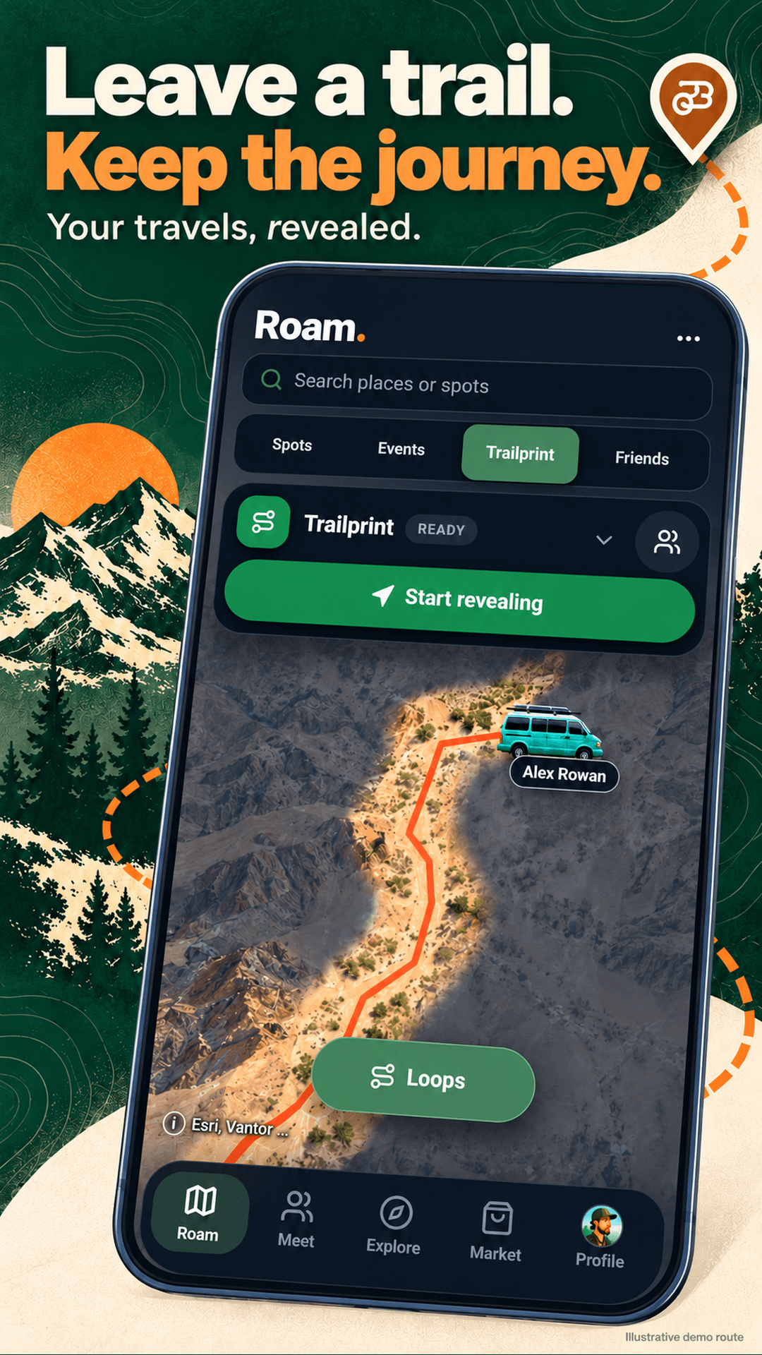
A map you uncover by traveling
Most maps begin with everything visible. Trailprint starts with the world hidden and reveals the places your recorded journey reaches. That fog-of-war idea makes a familiar road look different: a route becomes something you can look back at, rather than another line you were told to follow.
The fully revealed corridor reaches one statute mile, or 1,609.344 meters, from your route on either side. A softer edge blends the clear area into the fog. Taking the same road again does not mean you have explored another whole corridor: the map is a record of covered ground.
This is a travel record, not a claim that you visited every property or trail inside that corridor. A revealed patch is not permission to camp, drive off-road or enter private land.
How to start your first Trailprint
- Open Roam, then Trailprint. Read the location disclosure before choosing Start revealing.
- Allow the location access needed for your chosen recording mode. Background permissions and phone settings affect whether recording continues while the screen is locked.
- Travel normally. Do not handle the phone while driving; check the map when parked.
- Use Stop revealing when you want collection to end. Stopping keeps the history you already saved.
- Review your distance, area, travel streak and timeline. Choose all time, a month or a year to revisit a trip.
How states fit into your journey
RME also has a United States Journey view showing verified visited states. Trailprint verifies a state visit before you can attach state photos. You can look back at a state’s first-unlocked date and add memories to the states you have reached.
A state visit and the fog map answer different questions. The Journey view records that you reached a state; Trailprint shows the ground around your recorded path. Crossing a state border does not uncover every road inside that state. You can also show or hide state boundaries and names on the Trailprint map.
Your route is yours to control
Trailprint starts Private: only your account can see the exact route. Friends visibility allows mutual friends to view it. Public visibility allows signed-in RME members to view it on your profile. Consider what a detailed history can reveal about a home, workplace or regular overnight stop before changing that setting.
Friends Map is the separate feature for sharing an active location. Changing its location precision is not the same as changing who can see your saved Trailprint.
Trailprint data controls include a GeoJSON export and permanent deletion. Export first if you want your own copy. Deleting Trailprint removes its exact routes, unlocked area, XP and streak; stopping recording alone does not erase them. See RME’s privacy policy for the location-data explanation.
A useful record, with real-world limits
Precise location recording uses battery. Patchy service can leave recorded points waiting to sync, and loading new map imagery may still need a connection. Device restrictions or force-closing the app can interrupt collection, so check the recording status before relying on a complete trip history.
Try it on a short familiar walk or drive before a long trip. Then use the timeline to compare a weekend loop with a longer journey. If you are choosing the next trip, browse the 2027 events calendar or plan your costs with the free trip-budget calculator.
Frequently asked questions
Does Trailprint clear a mile or two miles?
Its fully revealed radius is one mile on each side of the recorded route, making a roughly two-mile-wide corridor. The edge is feathered.
Does entering a state reveal the whole state?
No. Verified state visits appear in your United States Journey; the fog map still follows the areas around your recorded route.
Is Trailprint the same as Friends Map?
No. Trailprint stores your travel history. Friends Map is the separate active-location sharing feature, with its own controls.
Can I stop recording without deleting the map?
Yes. Stop revealing ends new collection while preserving saved history. Export and permanent deletion are separate data controls.
Sources
Sources and further reading are listed below. Research dates and any illustrative assumptions are identified in the article. Tell us at support@roammeetexplore.com if something has changed.
Disclosure: RME publishes this page. We make RME. Other apps, events and tours mentioned are run by their respective organizations. Check their current details before making plans.